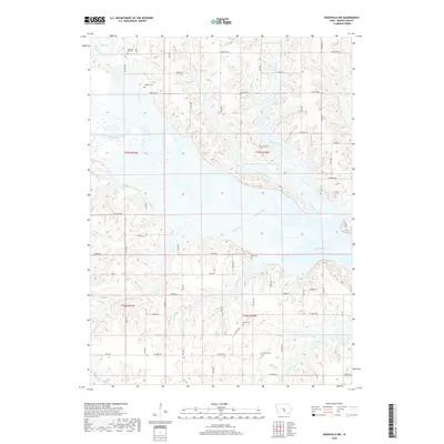
2018 Map of Knoxville NW
USGS Topo · Published 2018About this map
Lake Red Rock dominates the eastern landscape of this Marion County quadrangle, where the impounded Des Moines River transitions into a complex system of wooded inlets and creek mouths. Numerous rural burial grounds are preserved across the surrounding uplands, including Pleasant Hill Cem and Hughes Cem in the northwest, and Burch Cem near the southern boundary. These cemeteries, alongside Dunreath Cem and Schirey Cem, offer significant anchor points for local genealogical research in a landscape defined by its waterways.
Find a feature on this map
61 named features on this map. Tap any name to fly to it.
Don’t see what you’re looking for? This feature index may not catch every label — zoom into the map to look around manually.
Map Details
Editions of this 2018 Knoxville NW Map
This is the sole edition of this map. No revisions or reprints were ever made.
Other maps of this area

1909 · Knoxville
USGS Topo · 1:62,500

1910 · Milo
USGS Topo · 1:62,500

1912 · Knoxville
USGS Topo · 1:62,500

1930 · Mitchellville
USGS Topo · 1:62,500

1954 · Des Moines
USGS Topo · 1:250,000

1956 · Des Moines
USGS Topo · 1:250,000

1957 · Des Moines
USGS Topo · 1:250,000

1965 · Pleasantville
USGS Topo · 1:24,000

1965 · Prairie City
USGS Topo · 1:24,000

1965 · Knoxville NW
USGS Topo · 1:24,000
Featured Places
- Knoxville Township, IA
- Union Township, IA
- Red Rock Township, IA
- Pleasant Grove Township, IA
- Marion County, IA