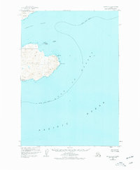
1949 Map of Kodiak A-3
USGS Topo · Published 1977About this map
Sitkalidak Island dominates this 1940s-era topographic study, separated from the larger landmass of Kodiak Island by the Sitkalidak Strait. The interior of the island shows a series of unnamed peaks rising above the coastline, while its easternmost reach is defined by Cape Barnabas and the nearby Barnabas coastal marker. These waters transition from the strait into the vast Gulf of Alaska and the Pacific Ocean.
Find a feature on this map
12 named features on this map. Tap any name to fly to it.
Don’t see what you’re looking for? This feature index may not catch every label — zoom into the map to look around manually.
Map Details
Editions of this 1949 Kodiak A-3 Map
3 editions found
Other maps of this area

1949 · Kodiak B-1 and B-2
USGS Topo · 1:63,360

1949 · Kodiak A-3
USGS Topo · 1:63,360

1949 · Kodiak B-3
USGS Topo · 1:63,360

1950 · Kodiak A-3
USGS Topo · 1:63,360

1950 · Kodiak B-3
USGS Topo · 1:63,360

1951 · Kaguyak
USGS Topo · 1:250,000

1951 · Kodiak B-1 and B-2
USGS Topo · 1:63,360

1952 · Kodiak
USGS Topo · 1:250,000

1952 · Kaguyak
USGS Topo · 1:250,000

1952 · Kodiak B-4
USGS Topo · 1:63,360