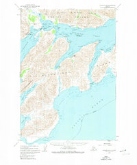
1952 Map of Kodiak A-4
USGS Topo · Published 1974About this map
Old Harbor and the surrounding coastline of Sitkalidak Island are preserved here in a period of maritime transition following the early 1950s. The map illustrates a landscape defined by industrial memory and remote navigation, most notably featuring the Whaling Sta (Aband) at Port Hobron, a remnant of the region's commercial whaling era. Further south, the tiny outpost of McCord sits near the head of the bay, while the Natalia Peninsula stretches toward the Pacific Ocean.
Find a feature on this map
33 named features on this map. Tap any name to fly to it.
Don’t see what you’re looking for? This feature index may not catch every label — zoom into the map to look around manually.
Map Details
Editions of this 1952 Kodiak A-4 Map
This is the sole edition of this map. No revisions or reprints were ever made.
Other maps of this area

1949 · Kodiak A-3
USGS Topo · 1:63,360

1949 · Kodiak B-3
USGS Topo · 1:63,360

1950 · Kodiak A-3
USGS Topo · 1:63,360

1950 · Kodiak B-3
USGS Topo · 1:63,360

1951 · Kaguyak
USGS Topo · 1:250,000

1952 · Kodiak
USGS Topo · 1:250,000

1952 · Kaguyak
USGS Topo · 1:250,000

1952 · Kaguyak D-5
USGS Topo · 1:63,360

1952 · Kodiak B-5
USGS Topo · 1:63,360

1952 · Kodiak B-4
USGS Topo · 1:63,360