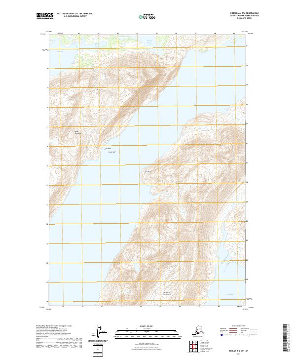
2021 Map of Kodiak A-6 SW
USGS Topo · Published 2021About this map
The Moser Peninsula and Hepburn Peninsula dominate this coastal landscape of Kodiak Island, where steep elevations rise sharply from the water's edge. The complex shoreline is punctuated by Olga Bay to the north and Sulia Bay to the south, connected by a network of protected inlets and navigable hazards. Navigation along the coast is marked by features such as Bear Rock, Bruin Reef, and the prominent Ivor Point. Inland, the hydrologic system is defined by the Horse Marine Stream, which connects Horse Marine Lake to the tidal waters of Horse Marine Lagoon. This survey documents the intersection of high alpine topography and the intricate marine environment of the Kodiak Island Borough, providing a clear record of the area's natural boundaries and drainage patterns.
Find a feature on this map
17 named features on this map. Tap any name to fly to it.
Don’t see what you’re looking for? This feature index may not catch every label — zoom into the map to look around manually.
Map Details
Editions of this 2021 Kodiak A-6 SW Map
This is the sole edition of this map. No revisions or reprints were ever made.
Other maps of this area

1951 · Kaguyak
USGS Topo · 1:250,000

1951 · Trinity Islands
USGS Topo · 1:250,000

1951 · Karluk
USGS Topo · 1:250,000

1952 · Kodiak
USGS Topo · 1:250,000

1952 · Kaguyak
USGS Topo · 1:250,000

1952 · Karluk
USGS Topo · 1:250,000

1952 · Trinity Islands D-1
USGS Topo · 1:63,360

1952 · Karluk A-1
USGS Topo · 1:63,360

1952 · Kaguyak D-6
USGS Topo · 1:63,360

1952 · Kodiak A-6
USGS Topo · 1:63,360