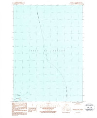
1987 Map of Kodiak C-1 NE
USGS Topo · Published 1988About this map
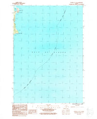
The vast waters of the Gulf of Alaska dominate this maritime survey, illustrating the treacherous coastline along the eastern reach of the archipelago. In the lower-left corner, the rugged shoreline of Ugak Island and the smaller Chiniak Island emerge from the sea, surrounded by hazardous formations including Rock Hole and numerous unnamed Rocks. This area is part of The Alaska Maritime National Wildlife Refuge, indicating the importance of these isolated islands for conservation and wildlife. The map also delineates the Kodiak Island Borough Indefinite Boundary as it stretches across the open ocean, providing a rare look at the jurisdictional limits of the era in these northern waters.
Find a feature on this map
13 named features on this map. Tap any name to fly to it.
Don’t see what you’re looking for? This feature index may not catch every label — zoom into the map to look around manually.
Map Details
Editions of this 1987 Kodiak C-1 NE Map
This is the sole edition of this map. No revisions or reprints were ever made.
Other maps of this area

1949 · Kodiak C-1
USGS Topo · 1:63,360

1949 · Kodiak D-1
USGS Topo · 1:63,360

1951 · Kodiak D-1
USGS Topo · 1:63,360

1951 · Kodiak C-1
USGS Topo · 1:63,360

1952 · Kodiak
USGS Topo · 1:250,000
1987 · Kodiak C-1 SW
USGS Topo · 1:25,000
1987 · Kodiak D-1 SW
USGS Topo · 1:25,000
1987 · Kodiak C-1 NW
USGS Topo · 1:25,000
1987 · Kodiak C-1 SE
USGS Topo · 1:25,000
2021 · Kodiak C-1 SE
USGS Topo · 1:25,000