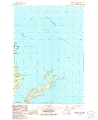
1987 Map of Kodiak D-1 SW
USGS Topo · Published 1988About this map
Woody Island and the larger Long Island define this coastal survey of the Kodiak archipelago during the late 1980s. The landscape is marked by the strategic presence of the U S Coast Guard Reservation at Spruce Cape, signaling the maritime importance of the Woody Island Channel. On the interior of the islands, a network of freshwater bodies like Long Lake, Elephant Lake, and Dolgoi Lake are mapped alongside a single Foot Trail that traverses the northern reaches of Long Island. The jagged coastline is heavy with navigational hazards and landmarks, from Sawmill Point to the prominent Lansing Bluff. A Radio Tower on Woody Island serves as a modern landmark overlooking Cook Bay, while numerous offshore features like Vasilief Rock and Williams Reef emphasize the intricate, rock-strewn waters of the Gulf of Alaska.
Find a feature on this map
34 named features on this map. Tap any name to fly to it.
Don’t see what you’re looking for? This feature index may not catch every label — zoom into the map to look around manually.
Map Details
Editions of this 1987 Kodiak D-1 SW Map
This is the sole edition of this map. No revisions or reprints were ever made.
Other maps of this area

1949 · Kodiak C-2
USGS Topo · 1:63,360

1949 · Kodiak D-2
USGS Topo · 1:63,360

1949 · Kodiak C-1
USGS Topo · 1:63,360

1949 · Kodiak D-1
USGS Topo · 1:63,360

1951 · Kodiak D-1
USGS Topo · 1:63,360

1951 · Kodiak D-2
USGS Topo · 1:63,360

1951 · Kodiak C-1
USGS Topo · 1:63,360

1952 · Kodiak
USGS Topo · 1:250,000
1987 · Kodiak C-2 NE
USGS Topo · 1:25,000
1987 · Kodiak C-1 NW
USGS Topo · 1:25,000