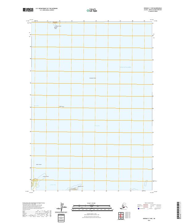
2021 Map of Kodiak C-1 NW
USGS Topo · Published 2021About this map
The coastal interface of Kodiak Island is defined here by the meeting of Kalsin Bay and Chiniak Bay, where the shoreline is punctuated by notable maritime hazards and geological formations. Navigation and coastal geography are the primary focus, with Kalsin Reef and the isolated Humpback Rock marking the waters of the Gulf of Alaska. Near the northern shoreline, Refuge Island and the adjacent Refuge Rock provide distinctive landmarks for the northern approaches, while the southern section is shaped by the narrow landform at Isthmus Point separating the bays.
Find a feature on this map
16 named features on this map. Tap any name to fly to it.
Don’t see what you’re looking for? This feature index may not catch every label — zoom into the map to look around manually.
Map Details
Editions of this 2021 Kodiak C-1 NW Map
This is the sole edition of this map. No revisions or reprints were ever made.
Other maps of this area

1949 · Kodiak C-2
USGS Topo · 1:63,360

1949 · Kodiak D-2
USGS Topo · 1:63,360

1949 · Kodiak C-1
USGS Topo · 1:63,360

1949 · Kodiak D-1
USGS Topo · 1:63,360

1951 · Kodiak D-1
USGS Topo · 1:63,360

1951 · Kodiak D-2
USGS Topo · 1:63,360

1951 · Kodiak C-1
USGS Topo · 1:63,360

1952 · Kodiak
USGS Topo · 1:250,000
1987 · Kodiak C-1 SW
USGS Topo · 1:25,000
1987 · Kodiak D-1 SW
USGS Topo · 1:25,000