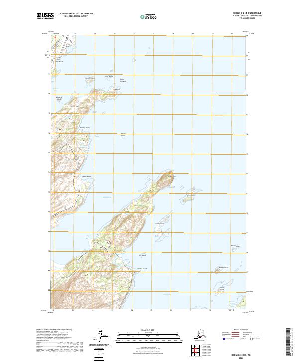
2021 Map of Kodiak C-2 NE
USGS Topo · Published 2021About this map
The Kodiak Airport and its surrounding coastal infrastructure dominate the northern reaches of this maritime landscape on Kodiak Island. The shoreline is characterized by a series of prominent bays including Womens Bay, Middle Bay, and Kalsin Bay, which are separated by significant landforms like Zaimka Ridge and Broad Point. The Chiniak Highway serves as the primary artery, threading south along the coast past a succession of recreation-oriented locations such as Holiday Beach and Happy Beach. Inland, the terrain rises sharply toward elevations that feed small water bodies like Mayflower Lake and Horseshoe Lake. The offshore environment is dotted with numerous small landmasses, including Kalsin Island and Isthmus Island, illustrating the complex coastal geography of the Gulf of Alaska in the early twenty-first century.
Find a feature on this map
37 named features on this map. Tap any name to fly to it.
Don’t see what you’re looking for? This feature index may not catch every label — zoom into the map to look around manually.
Map Details
Editions of this 2021 Kodiak C-2 NE Map
This is the sole edition of this map. No revisions or reprints were ever made.
Other maps of this area

1949 · Kodiak C-2
USGS Topo · 1:63,360

1949 · Kodiak D-2
USGS Topo · 1:63,360

1949 · Kodiak C-1
USGS Topo · 1:63,360

1949 · Kodiak D-1
USGS Topo · 1:63,360

1951 · Kodiak D-1
USGS Topo · 1:63,360

1951 · Kodiak D-2
USGS Topo · 1:63,360

1951 · Kodiak C-1
USGS Topo · 1:63,360

1952 · Kodiak
USGS Topo · 1:250,000
1987 · Kodiak C-1 SW
USGS Topo · 1:25,000
1987 · Kodiak D-1 SW
USGS Topo · 1:25,000