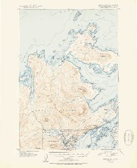
1951 Map of Kodiak D-2
USGS Topo · Published 1951About this map
The port of Kodiak and the neighboring village of Uzinki anchor this 1951 study of the northeastern coast of Kodiak Island. The landscape is dominated by the sprawling Fort Greeley Military Reservation and the adjacent US Naval Reservation, reflecting the region's strategic importance during and after World War II. Coastal navigation relies on markers like Three Brothers Light and Otmeloi Light, while the interior terrain is defined by dramatic peaks including Pillar Mountain, the jagged Devils Prongs, and Three Sisters. To the north, Spruce Island rises to Mount Herman, separated from the main island by the Narrow Strait. This document captures a maritime and military geography at a time when radio communication towers and naval outposts were as central to the landscape as the fishing waters of Kizhuyak Bay and Marmot Bay.
Find a feature on this map
95 named features on this map. Tap any name to fly to it.
Don’t see what you’re looking for? This feature index may not catch every label — zoom into the map to look around manually.
Map Details
Editions of this 1951 Kodiak D-2 Map
2 editions found
Other maps of this area

1947 · Kodiak D-3
USGS Topo · 1:63,360

1949 · Kodiak C-2
USGS Topo · 1:63,360

1949 · Kodiak D-2
USGS Topo · 1:63,360

1949 · Kodiak D-3
USGS Topo · 1:63,360

1949 · Kodiak C-1
USGS Topo · 1:63,360

1949 · Kodiak D-1
USGS Topo · 1:63,360

1950 · Kodiak D-3
USGS Topo · 1:63,360

1951 · Kodiak D-1
USGS Topo · 1:63,360

1951 · Kodiak D-2
USGS Topo · 1:63,360

1951 · Kodiak C-1
USGS Topo · 1:63,360