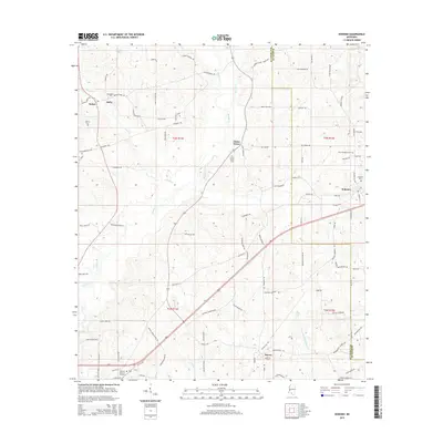
2015 Map of Kokomo
USGS Topo · Published 2015About this map
Magees Cr and its various tributaries, including Varnell Cr and Collins Cr, carve through the rolling landscape of eastern Walthall County. The area is defined by a dense network of family-named rural roads, such as Johnnie Foxworth Rd and Lollie Magee Rd, which connect small communities like Salem and China Grove. This 2015 survey reveals a terrain deeply rooted in local history, evidenced by the numerous burial grounds and religious centers scattered across the townships, including the Salem Church and the China Grove Cem. Along the southeastern edge, the settlement of Knoxo and the Kokomo area sit near the border of Marion County. The map provides a precise look at the rural geography just before the modern era of expansion, where Hillcrest Memorial Gardens and New Damascus Cem serve as permanent landmarks for genealogists and local historians tracing the heritage of these Mississippi crossroads.
Find a feature on this map
99 named features on this map. Tap any name to fly to it.
Don’t see what you’re looking for? This feature index may not catch every label — zoom into the map to look around manually.
Map Details
Editions of this 2015 Kokomo Map
This is the sole edition of this map. No revisions or reprints were ever made.
Other maps of this area

1953 · Hattiesburg
USGS Topo · 1:250,000

1953 · Natchez
USGS Topo · 1:250,000

1956 · Natchez
USGS Topo · 1:250,000

1958 · Hattiesburg
USGS Topo · 1:250,000

1959 · Natchez
USGS Topo · 1:250,000

1970 · Sandy Hook NW
USGS Topo · 1:24,000
1970 · Tylertown SE
USGS Topo · 1:24,000

1970 · Kokomo
USGS Topo · 1:24,000

1970 · Mesa
USGS Topo · 1:24,000

1970 · Darbun
USGS Topo · 1:24,000