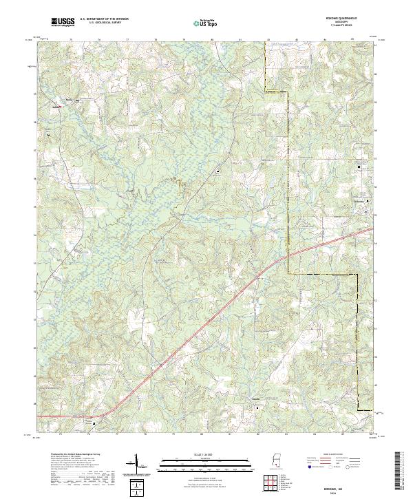
2024 Map of Kokomo
USGS Topo · Published 2024About this map
Magees Creek and its many tributaries, including Union Creek and Collins Creek, define the landscape of this region along the Marion and Walthall County line. Small communities and rural settlements like Kokomo, Salem, Knoxo, and Melis are connected by a network of backroads such as Darbun China Grove Road and Old Holmesville Road. The area is notably dense with spiritual and memorial sites, suggesting a long history of established family homesteads. Genealogists can trace local roots through numerous landmarks, including Salem Church, New Damascus Missionary Baptist Church, and several burial grounds like China Grove Cemetery and the Knoxo Cemetery. The terrain rises toward Dillon Hill in the southwest, while the eastern edge is marked by the winding path of Tenmile Creek.
Find a feature on this map
101 named features on this map. Tap any name to fly to it.
Don’t see what you’re looking for? This feature index may not catch every label — zoom into the map to look around manually.
Map Details
Editions of this 2024 Kokomo Map
This is the sole edition of this map. No revisions or reprints were ever made.
Other maps of this area

1953 · Hattiesburg
USGS Topo · 1:250,000

1953 · Natchez
USGS Topo · 1:250,000

1956 · Natchez
USGS Topo · 1:250,000

1958 · Hattiesburg
USGS Topo · 1:250,000

1959 · Natchez
USGS Topo · 1:250,000

1970 · Sandy Hook NW
USGS Topo · 1:24,000
1970 · Tylertown SE
USGS Topo · 1:24,000

1970 · Kokomo
USGS Topo · 1:24,000

1970 · Mesa
USGS Topo · 1:24,000

1970 · Darbun
USGS Topo · 1:24,000