
1970 Map of Kokomo
USGS Topo · Published 1972About this map
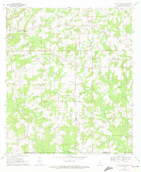
Magees Creek winds through the rural borderlands of Marion and Walthall counties, defining a landscape shaped by small timber-and-farm settlements. In the early 1970s, the area around Kokomo and Knoxo shows a transition toward energy extraction, evidenced by numerous Gas Wells and a prominent Pipeline cutting across the terrain. These industrial additions contrast with the established network of country churches like New Bethel Ch and China Grove Ch, which served as the social anchors for this Mississippi backcountry.
Find a feature on this map
38 named features on this map. Tap any name to fly to it.
Don’t see what you’re looking for? This feature index may not catch every label — zoom into the map to look around manually.
Map Details
Editions of this 1970 Kokomo Map
This is the sole edition of this map. No revisions or reprints were ever made.
Other maps of this area

1953 · Hattiesburg
USGS Topo · 1:250,000

1953 · Natchez
USGS Topo · 1:250,000

1956 · Natchez
USGS Topo · 1:250,000

1958 · Hattiesburg
USGS Topo · 1:250,000

1959 · Natchez
USGS Topo · 1:250,000

1970 · Sandy Hook NW
USGS Topo · 1:24,000
1970 · Tylertown SE
USGS Topo · 1:24,000

1970 · Mesa
USGS Topo · 1:24,000

1970 · Darbun
USGS Topo · 1:24,000
1970 · Dexter
USGS Topo · 1:24,000