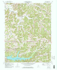
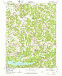
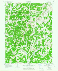
1978 Map of Koleen
USGS Topo · Published 1979About this map
The settlement of Koleen serves as a focal point in this southern Indiana landscape, where the rugged topography of Taylor Ridge and Hard Scrabble Ridge dictates the placement of early roads and homesteads. The southern portion of the territory is dominated by the U S Naval Reservation Weapons Support Center, an expansive federal installation that significantly altered the local geography, including the creation of Lake Greenwood and Oberlin Lake.
Find a feature on this map
41 named features on this map. Tap any name to fly to it.
Don’t see what you’re looking for? This feature index may not catch every label — zoom into the map to look around manually.
Map Details
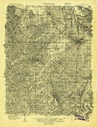
Editions of this 1978 Koleen Map
2 editions found
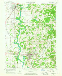
Other maps of this area
1908 · Bloomington
USGS Topo · 1:48,000
1908 · Bloomfield
USGS Topo · 1:62,500
1910 · Bloomington
USGS Topo · 1:62,500

1935 · Oolitic
USGS Topo · 1:48,000

1942 · Oolitic
USGS Topo · 1:62,500
1950 · Odon
USGS Topo · 1:24,000
1951 · Bloomfield
USGS Topo · 1:24,000

1953 · Indianapolis
USGS Topo · 1:250,000

1956 · Indianapolis
USGS Topo · 1:250,000
1956 · Stanford
USGS Topo · 1:24,000