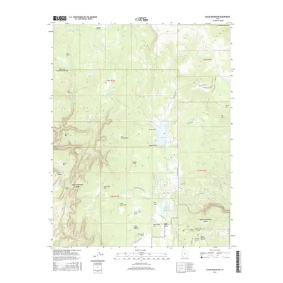
2017 Map of Kolob Reservoir
USGS Topo · Published 2017About this map
Zion National Park encompasses the southern portion of this high-altitude landscape, where the Colorado Plateau drops toward the Virgin River drainage. The map centers on the high desert oasis of Kolob Reservoir, a critical water source in the arid back-country of Washington County. This area is defined by massive topographic features like the Upper Kolob Plateau and Horse Pasture Plateau, dissected by dramatic erosional cuts such as Wildcat Canyon and Bear Trap Canyon. Ancient volcanic activity is evident at Lava Point, while the surrounding terrain is marked by prominent summits including Kolob Peak and Little Creek Peak. Navigating this wilderness is documented through routes like the La Verkin Creek Trail and the W Rim Trail, which provide access to remote areas like The Hardscrabble and The Pillars. The presence of numerous springs, such as Birch Spring and Mud Spring, highlights the sparse but vital water network that has supported seasonal grazing and ranching in the region for generations.
Find a feature on this map
65 named features on this map. Tap any name to fly to it.
Don’t see what you’re looking for? This feature index may not catch every label — zoom into the map to look around manually.
Map Details
Editions of this 2017 Kolob Reservoir Map
This is the sole edition of this map. No revisions or reprints were ever made.
Other maps of this area

1885 · St. George
USGS Topo · 1:250,000

1886 · Kanab
USGS Topo · 1:250,000

1891 · St. George
USGS Topo · 1:250,000

1950 · Kanarraville
USGS Topo · 1:24,000

1950 · Cedar City
USGS Topo · 1:62,500

1950 · Cedar Mountain
USGS Topo · 1:24,000

1951 · Kanarraville
USGS Topo · 1:24,000

1952 · Cedar Mountain
USGS Topo · 1:24,000

1953 · Cedar City
USGS Topo · 1:250,000

1954 · Orderville Canyon NW
USGS Topo · 1:24,000