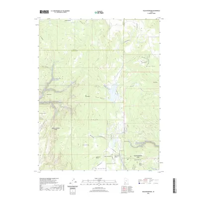
2020 Map of Kolob Reservoir
USGS Topo · Published 2020About this map
Zion National Park encompasses the southern portion of this high-altitude landscape, where the plateau drops into steep drainage systems. The Virgin Wild and Scenic River and Kolob Creek serve as primary hydrologic arteries, carving deep canyons such as Bear Canyon and Wildcat Canyon. This era of the landscape is defined by a mix of protected wilderness and high-country ranching infrastructure, evidenced by the network of mountain roads like Kolob Mountain Ranch Rd and Thorely Ranch Rd.
Find a feature on this map
59 named features on this map. Tap any name to fly to it.
Don’t see what you’re looking for? This feature index may not catch every label — zoom into the map to look around manually.
Map Details
Editions of this 2020 Kolob Reservoir Map
This is the sole edition of this map. No revisions or reprints were ever made.
Other maps of this area

1885 · St. George
USGS Topo · 1:250,000

1886 · Kanab
USGS Topo · 1:250,000

1891 · St. George
USGS Topo · 1:250,000

1950 · Kanarraville
USGS Topo · 1:24,000

1950 · Cedar City
USGS Topo · 1:62,500

1950 · Cedar Mountain
USGS Topo · 1:24,000

1951 · Kanarraville
USGS Topo · 1:24,000

1952 · Cedar Mountain
USGS Topo · 1:24,000

1953 · Cedar City
USGS Topo · 1:250,000

1954 · Orderville Canyon NW
USGS Topo · 1:24,000