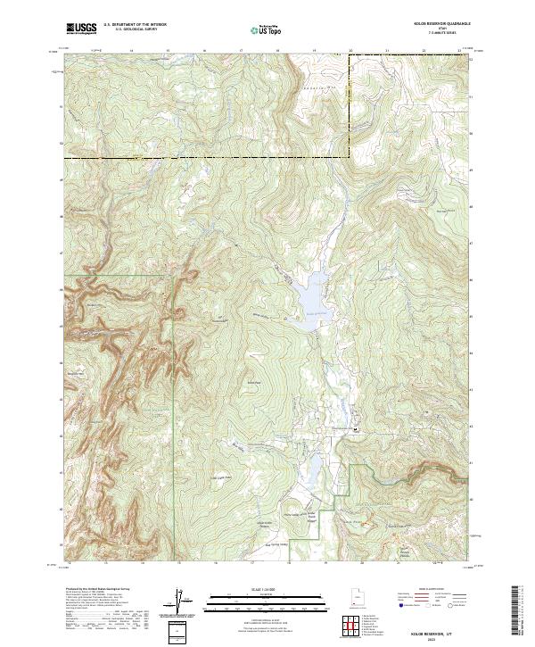
2023 Map of Kolob Reservoir
USGS Topo · Published 2023About this map
High-elevation desert and riparian landscapes converge at Kolob Reservoir, a critical water resource for the surrounding plateau country. This modern survey illustrates the complex management of public lands, where the Zion National Park boundary meets the Zion Wilderness and several other protected areas like the Laverkin Creek Wilderness. The topography is defined by dramatic elevation shifts, ranging from the depths of Bear Trap Canyon to the heights of Kolob Peak and Kanarra Mtn. Traceable human imprints are scattered throughout this backcountry, including the Kolob Mountain Cem and the small settlement of Barker. The map also details the course of the Virgin Wild and Scenic River, documenting how water systems like Laverkin Creek and Kolob Creek have carved the intricate canyon networks of the Colorado Plateau.
Find a feature on this map
96 named features on this map. Tap any name to fly to it.
Don’t see what you’re looking for? This feature index may not catch every label — zoom into the map to look around manually.
Map Details
Editions of this 2023 Kolob Reservoir Map
This is the sole edition of this map. No revisions or reprints were ever made.
Other maps of this area

1885 · St. George
USGS Topo · 1:250,000

1886 · Kanab
USGS Topo · 1:250,000

1891 · St. George
USGS Topo · 1:250,000

1950 · Kanarraville
USGS Topo · 1:24,000

1950 · Cedar City
USGS Topo · 1:62,500

1950 · Cedar Mountain
USGS Topo · 1:24,000

1951 · Kanarraville
USGS Topo · 1:24,000

1952 · Cedar Mountain
USGS Topo · 1:24,000

1953 · Cedar City
USGS Topo · 1:250,000

1954 · Orderville Canyon NW
USGS Topo · 1:24,000