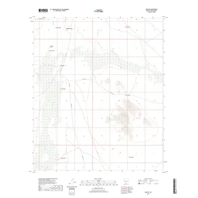
2018 Map of Kom Vo
USGS Topo · Published 2018About this map
Kom Vo and the surrounding desert basin of Quijotoa Valley are documented here in this 2018 survey of Pima County. The landscape is defined by its seasonal drainage systems, including the wide paths of Vamori Wash and Gu Vo Wash, which channel water across this arid terrain toward the lower elevations. These washes form the primary natural framework for the region, influencing the placement of local settlements and transit routes.
Find a feature on this map
18 named features on this map. Tap any name to fly to it.
Don’t see what you’re looking for? This feature index may not catch every label — zoom into the map to look around manually.
Map Details
Editions of this 2018 Kom Vo Map
This is the sole edition of this map. No revisions or reprints were ever made.
Other maps of this area

1953 · Ajo
USGS Topo · 1:250,000

1954 · Sonoyta
USGS Topo · 1:250,000

1957 · Ajo
USGS Topo · 1:250,000

1958 · Ajo
USGS Topo · 1:250,000

1962 · Ajo
USGS Topo · 1:250,000

1963 · Ajo
USGS Topo · 1:250,000

1963 · Kom Vo
USGS Topo · 1:62,500

1963 · Gu Oidak
USGS Topo · 1:62,500

1963 · Quijotoa Mts
USGS Topo · 1:62,500

1963 · Pisinimo
USGS Topo · 1:62,500
Featured Places
- Chukut Kuk District, AZ
- Pisinemo District, AZ
- Tatk Kam Vo, Pisinemo District
- Kom Vo, Pisinemo District
- Pima County, AZ