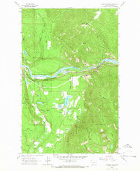
1963 Map of Kootenai Falls
USGS Topo · Published 1966About this map
The Kootenai River carves a dramatic path through this 1960s landscape, featuring the powerful drop of Kootenai Falls and the engineering of the Great Northern railroad line that follows its banks. Just south of the river, a cluster of small lakes including Savage Lake, Schoolhouse Lake, and Milnor Lake suggests a localized pocket of settlement and recreation. Near these lakes, the Larchwood Cem provides a specific point of interest for genealogists tracing local families.
Find a feature on this map
41 named features on this map. Tap any name to fly to it.
Don’t see what you’re looking for? This feature index may not catch every label — zoom into the map to look around manually.
Map Details
Editions of this 1963 Kootenai Falls Map
2 editions found
Other maps of this area

1920 · Libby
USGS Topo · 1:125,000

1930 · Libby
USGS Topo · 1:125,000

1932 · Libby
USGS Topo · 1:125,000

1957 · Kalispell
USGS Topo · 1:250,000

1960 · Kalispell
USGS Topo · 1:250,000

1961 · Kalispell
USGS Topo · 1:250,000

1963 · Scenery Mountain
USGS Topo · 1:24,000
1963 · Spar Lake
USGS Topo · 1:24,000

1963 · Turner Mountain
USGS Topo · 1:24,000

1963 · Pulpit Mountain
USGS Topo · 1:24,000