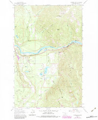
1963 Map of Kootenai Falls
USGS Topo · Published 1984About this map
The Kootenai River carves a dramatic path through this section of the Kootenai National Forest, where the Burlington Northern railroad tracks parallel the water through the steep canyon. This landscape is defined by the transition from the relatively open Lynx Flats in the north to the high summits of the Cabinet Mountains in the south, anchored by the prominent Taylor Peak.
Find a feature on this map
38 named features on this map. Tap any name to fly to it.
Don’t see what you’re looking for? This feature index may not catch every label — zoom into the map to look around manually.
Map Details
Editions of this 1963 Kootenai Falls Map
2 editions found
Other maps of this area

1920 · Libby
USGS Topo · 1:125,000

1930 · Libby
USGS Topo · 1:125,000

1932 · Libby
USGS Topo · 1:125,000

1957 · Kalispell
USGS Topo · 1:250,000

1960 · Kalispell
USGS Topo · 1:250,000

1961 · Kalispell
USGS Topo · 1:250,000

1963 · Scenery Mountain
USGS Topo · 1:24,000
1963 · Spar Lake
USGS Topo · 1:24,000

1963 · Turner Mountain
USGS Topo · 1:24,000

1963 · Pulpit Mountain
USGS Topo · 1:24,000