
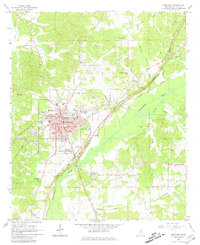
1964 Map of Kosciusko
USGS Topo · Published 1965About this map
Kosciusko functions as the central hub of this 1964 survey, shown during a period of significant municipal growth as the red-tinted urban core expands toward the Illinois Central railroad. The town's educational and social fabric is clearly defined by landmarks such as Gilliland College, the Tipton St Sch, and the Lucas Fairground. Outside the city center, the landscape is defined by the winding path of the Yockanookany River and its Old Channel, where the Natchez Trace Parkway cuts diagonally across the river bottomlands.
Find a feature on this map
47 named features on this map. Tap any name to fly to it.
Don’t see what you’re looking for? This feature index may not catch every label — zoom into the map to look around manually.
Map Details
Editions of this 1964 Kosciusko Map
2 editions found
Other maps of this area

1953 · Meridian
USGS Topo · 1:250,000

1953 · West Point
USGS Topo · 1:250,000

1957 · Meridian
USGS Topo · 1:250,000

1958 · West Point
USGS Topo · 1:250,000

1962 · Edinburg
USGS Topo · 1:62,500

1962 · Thomastown
USGS Topo · 1:62,500

1963 · West Point
USGS Topo · 1:250,000

1964 · Kosciusko NE
USGS Topo · 1:24,000

1964 · Hesterville
USGS Topo · 1:24,000
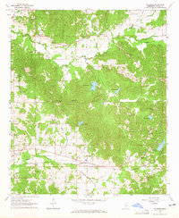
1964 · McAdams
USGS Topo · 1:24,000