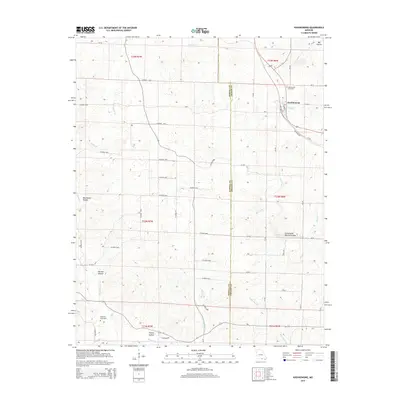
2015 Map of Koshkonong
USGS Topo · Published 2015About this map
Koshkonong serves as the primary hub of this Missouri landscape, situated where the BNSF Railway cuts through the borderlands of Howell and Oregon counties. The town's grid, including Bingham St and Luyster St, sits just south of the Koshkonong Cemetery. This topography is defined by its karst-like features, most notably the Grand Gulf and the Grand Gulf Natural Bridge, which represent a significant geological point of interest south of the town center. The surrounding countryside is deeply etched by a network of drainage hollows and creeks, including Harmon Hollow, Red Ranch Hollow, and the winding Myatt Cr. For those researching local family history, the map preserves the location of smaller sites like Koellings Graveyard and Sherry Hollow, alongside rural routes like Mo-F and Mo-W that connect these remote homesteads and valleys.
Find a feature on this map
65 named features on this map. Tap any name to fly to it.
Don’t see what you’re looking for? This feature index may not catch every label — zoom into the map to look around manually.
Map Details
Editions of this 2015 Koshkonong Map
This is the sole edition of this map. No revisions or reprints were ever made.
Other maps of this area

1938 · West Plains
USGS Topo · 1:24,000

1940 · West Plains
USGS Topo · 1:24,000

1943 · Thayer
USGS Topo · 1:62,500

1944 · West Plains
USGS Topo · 1:62,500

1946 · Thayer
USGS Topo · 1:62,500

1946 · West Plains
USGS Topo · 1:62,500

1950 · Salem
USGS Topo · 1:62,500

1951 · Salem
USGS Topo · 1:62,500

1957 · Poplar Bluff
USGS Topo · 1:250,000

1959 · Poplar Bluff
USGS Topo · 1:250,000