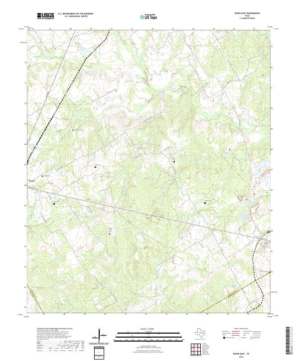
2022 Map of Kosse East
USGS Topo · Published 2022About this map
The town of Kosse anchors the western edge of this East Texas landscape, where the agricultural plains meet a dense network of creek drainages. Numerous family and community burial grounds, such as Eutaw Cem and Sowders Cem, are scattered across the terrain, reflecting the deep-rooted rural settlement patterns of Limestone County. The land is defined by winding watercourses like Steele Cr and Polecat Cr, which carved the undulating topography long before the modern road grid of County Roads and Limestone County Routes was established.
Find a feature on this map
69 named features on this map. Tap any name to fly to it.
Don’t see what you’re looking for? This feature index may not catch every label — zoom into the map to look around manually.
Map Details
Editions of this 2022 Kosse East Map
This is the sole edition of this map. No revisions or reprints were ever made.
Other maps of this area

1927 · Marquez
USGS Topo · 1:62,500

1930 · Marquez
USGS Topo · 1:62,500

1954 · Waco
USGS Topo · 1:250,000

1955 · Waco
USGS Topo · 1:250,000

1962 · Bremond
USGS Topo · 1:24,000

1962 · Petteway
USGS Topo · 1:24,000
1965 · Bald Prairie
USGS Topo · 1:24,000

1965 · Kosse West
USGS Topo · 1:24,000

1966 · Thornton
USGS Topo · 1:24,000
1966 · Box Church
USGS Topo · 1:24,000