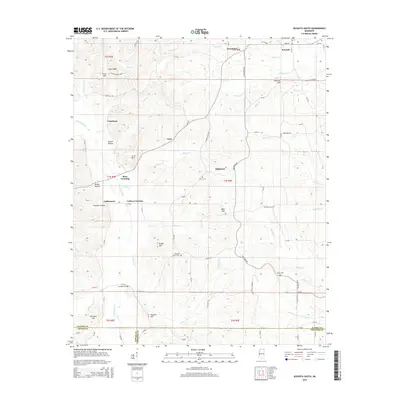
2015 Map of Kossuth South
USGS Topo · Published 2015About this map
Kossuth and its surrounding communities in Alcorn County are mapped here in the modern era, revealing a landscape defined by the upper reaches of the Hatchie River and its numerous tributaries. The geography is characterized by named ridges and peaks such as Elam Ridge, Crum Mtn, and Hancock Hill, which separate the various creek valleys. A notable local landmark is the Crum B. Mayney Orch situated near Crumtown. Genealogists will find value in the location of several rural burial grounds, including Union Cem, Pleasant Grove Cem, and Alcorn Cem. The map traces a network of small settlements and crossing points like Ross Crossing, Collins Crossing, and Hightown, while the Turnpike Bridge spans the river to the south. This area, where the boundaries of Alcorn, Tippah, and Prentiss counties converge, maintains its character as a region of dispersed homesteads and small-scale agriculture connected by a dense web of county roads.
Find a feature on this map
96 named features on this map. Tap any name to fly to it.
Don’t see what you’re looking for? This feature index may not catch every label — zoom into the map to look around manually.
Map Details
Editions of this 2015 Kossuth South Map
This is the sole edition of this map. No revisions or reprints were ever made.
Other maps of this area

1921 · Booneville
USGS Topo · 1:48,000

1922 · Booneville
USGS Topo · 1:62,500

1950 · Corinth
USGS Topo · 1:62,500

1951 · Walnut
USGS Topo · 1:62,500

1955 · Ripley
USGS Topo · 1:62,500

1956 · Tupelo
USGS Topo · 1:250,000

1958 · Tupelo
USGS Topo · 1:250,000

1972 · Jumpertown
USGS Topo · 1:24,000
1973 · Booneville
USGS Topo · 1:24,000
1982 · Kossuth South
USGS Topo · 1:24,000