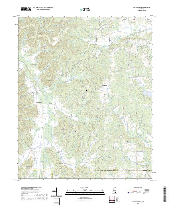
2024 Map of Kossuth South
USGS Topo · Published 2024About this map
Kossuth anchors the northeastern corner of this landscape, where the headwaters of Kossuth Creek and Mills Creek begin their drainage. The terrain is defined by a dense network of ridges and hollows, including Elam Ridge and Kellum Hollow, which influence the local road patterns and historical settlement clusters. Further south, small communities like Crumtown, Collinstown, and Hightown are situated among prominent heights such as Crow Mountain and Bragg Mountain.
Find a feature on this map
97 named features on this map. Tap any name to fly to it.
Don’t see what you’re looking for? This feature index may not catch every label — zoom into the map to look around manually.
Map Details
Editions of this 2024 Kossuth South Map
This is the sole edition of this map. No revisions or reprints were ever made.
Other maps of this area

1921 · Booneville
USGS Topo · 1:48,000

1922 · Booneville
USGS Topo · 1:62,500

1950 · Corinth
USGS Topo · 1:62,500

1951 · Walnut
USGS Topo · 1:62,500

1955 · Ripley
USGS Topo · 1:62,500

1956 · Tupelo
USGS Topo · 1:250,000

1958 · Tupelo
USGS Topo · 1:250,000

1972 · Jumpertown
USGS Topo · 1:24,000
1973 · Booneville
USGS Topo · 1:24,000
1982 · Kossuth South
USGS Topo · 1:24,000