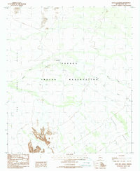
1988 Map of Kots Kug Ranch
USGS Topo · Published 1988About this map
Kots Kug Ranch lies at the heart of this landscape within the Papago Indian Reservation, an area defined by its desert drainages and water management. Mapping here illustrates the seasonal flow of the Chukut Kuk Wash and Big Wash as they cross the broad expanse of The Great Plain. Small-scale ranching infrastructure is evident throughout the sheet, including a Corral and a series of Check Dams designed to capture runoff in this arid environment.
Find a feature on this map
14 named features on this map. Tap any name to fly to it.
Don’t see what you’re looking for? This feature index may not catch every label — zoom into the map to look around manually.
Map Details
Editions of this 1988 Kots Kug Ranch Map
This is the sole edition of this map. No revisions or reprints were ever made.
Other maps of this area

1954 · Sonoyta
USGS Topo · 1:250,000

1963 · Kom Vo
USGS Topo · 1:62,500

1963 · Gu Oidak
USGS Topo · 1:62,500
1963 · La Lesna Mts.
USGS Topo · 1:62,500

1963 · Lukeville
USGS Topo · 1:250,000
1988 · Chukut Kuk
USGS Topo · 1:24,000
1988 · Kom Vo
USGS Topo · 1:24,000
1988 · Gu Oidak
USGS Topo · 1:24,000
1988 · Tecolote Ranch
USGS Topo · 1:24,000
1988 · Kupk
USGS Topo · 1:24,000