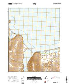
2018 Map of Kotzebue A-2 SE
USGS Topo · Published 2018About this map
Deering sits at the edge of Kotzebue Sound where the Inmachuk River meets the sea. This coastal settlement is defined by its relationship with the water and the prominent geographical feature of Cape Deceit to the west. The local infrastructure is clearly mapped, including the central Po and the grid of Front Street and Deering Road. To the south, the landscape transitions into the expansive Kugruk Lagoon, illustrating the interplay of tide and river delta in this corner of the Northwest Arctic Borough. The terrain is marked by gentle slopes rising from the coastline, with Smith Creek flowing north toward the village, providing a snapshot of a remote maritime hub reliant on its immediate geography for access and resources.
Find a feature on this map
14 named features on this map. Tap any name to fly to it.
Don’t see what you’re looking for? This feature index may not catch every label — zoom into the map to look around manually.
Map Details
Editions of this 2018 Kotzebue A-2 SE Map
This is the sole edition of this map. No revisions or reprints were ever made.
Other maps of this area

1950 · Kotzebue A-1
USGS Topo · 1:63,360

1950 · Bendeleben D-2
USGS Topo · 1:63,360

1950 · Bendeleben
USGS Topo · 1:250,000

1950 · Bendeleben D-1
USGS Topo · 1:63,360

1950 · Kotzebue A-2
USGS Topo · 1:63,360

1951 · Bendeleben
USGS Topo · 1:250,000

1951 · Kotzebue
USGS Topo · 1:250,000

1958 · Kotzebue
USGS Topo · 1:250,000

1964 · Bendeleben
USGS Topo · 1:250,000

1964 · Kotzebue
USGS Topo · 1:250,000