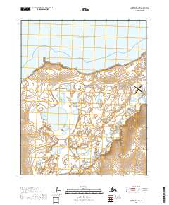
2018 Map of Kotzebue A-2 SW
USGS Topo · Published 2018About this map
Kotzebue Sound dominates the northern horizon of this coastal landscape, where the tides meet the dramatic projection of Toawlevic Point. The terrain is defined by a intricate network of tundra waterways and thermokarst lakes, most notably the meandering paths of Smith Creek and the Inmachuk River. Human presence is concentrated along the coastal corridor, anchored by the Deering Airport and the vital connectivity of Deering Road. To the south, Iowa Creek winds through the wetlands, illustrating the seasonal drainage patterns typical of the Seward Peninsula. This 2018 survey documents the modern infrastructure supporting local aviation and transit while tracing the unchanging natural features of the Alaskan shoreline.
Find a feature on this map
14 named features on this map. Tap any name to fly to it.
Don’t see what you’re looking for? This feature index may not catch every label — zoom into the map to look around manually.
Map Details
Editions of this 2018 Kotzebue A-2 SW Map
This is the sole edition of this map. No revisions or reprints were ever made.
Other maps of this area

1950 · Bendeleben D-2
USGS Topo · 1:63,360

1950 · Bendeleben
USGS Topo · 1:250,000

1950 · Bendeleben D-3
USGS Topo · 1:63,360

1950 · Kotzebue A-3
USGS Topo · 1:63,360

1950 · Kotzebue A-2
USGS Topo · 1:63,360

1951 · Bendeleben
USGS Topo · 1:250,000

1951 · Kotzebue
USGS Topo · 1:250,000

1958 · Kotzebue
USGS Topo · 1:250,000

1964 · Bendeleben
USGS Topo · 1:250,000

1964 · Kotzebue
USGS Topo · 1:250,000