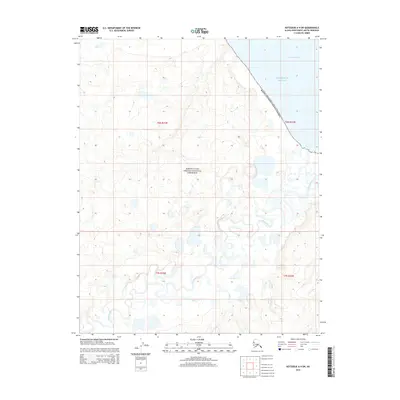
2014 Map of Kotzebue A-4 SW
USGS Topo · Published 2014About this map
The Bering Land Bridge National Preserve encompasses most of this landscape, protecting a remote coastal stretch along Kotzebue Sound. This 2014 survey illustrates the complex hydrology of the Seward Peninsula's northern coast, where the meandering Goodhope River flows toward its outlet at Goodhope Bay. The terrain is characterized by a dense network of thermokarst lakes and small drainages, including Eagle Cr and Pot Cr, which indicate a permafrost-influenced environment. These features highlight the intersection of arctic wetland ecology and protected federal lands in the Northwest Arctic Borough. The lack of roads or permanent structures reflects the region's character as a preserved wilderness area, accessible primarily by water or air, maintaining the same geographic profile it has held for generations.
Find a feature on this map
10 named features on this map. Tap any name to fly to it.
Don’t see what you’re looking for? This feature index may not catch every label — zoom into the map to look around manually.
Map Details
Editions of this 2014 Kotzebue A-4 SW Map
This is the sole edition of this map. No revisions or reprints were ever made.
Other maps of this area

1950 · Bendeleben D-5
USGS Topo · 1:63,360

1950 · Bendeleben
USGS Topo · 1:250,000

1950 · Bendeleben D-4
USGS Topo · 1:63,360

1950 · Kotzebue A-4
USGS Topo · 1:63,360

1950 · Kotzebue A-5
USGS Topo · 1:63,360

1951 · Bendeleben
USGS Topo · 1:250,000

1951 · Kotzebue
USGS Topo · 1:250,000

1958 · Kotzebue
USGS Topo · 1:250,000

1964 · Bendeleben
USGS Topo · 1:250,000

1964 · Kotzebue
USGS Topo · 1:250,000