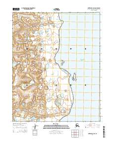
2014 Map of Kotzebue B-4 SW
USGS Topo · Published 2014About this map
Bering Land Bridge National Preserve encompasses a vast stretch of the Seward Peninsula coastline along the eastern margins of Kotzebue Sound. This 2014 survey captures a landscape defined by low-lying tundra and intricate drainage patterns, where the winding waters of Kungealoruk Cr and Kougachuk Cr flow toward the coast. The mapping of the Public Land Survey System grids, including t11n r25w and t10n r25w, illustrates the administrative structure overlaid upon this remote subarctic environment. For those studying the hydrology of the Northwest Arctic, the map provides precise data on the meandering stream channels and shoreline morphology at the edge of the Chukchi Sea.
Find a feature on this map
8 named features on this map. Tap any name to fly to it.
Don’t see what you’re looking for? This feature index may not catch every label — zoom into the map to look around manually.
Map Details
Editions of this 2014 Kotzebue B-4 SW Map
This is the sole edition of this map. No revisions or reprints were ever made.
Other maps of this area

1950 · Kotzebue B-4
USGS Topo · 1:63,360

1950 · Kotzebue B-5
USGS Topo · 1:63,360

1950 · Kotzebue A-4
USGS Topo · 1:63,360

1950 · Kotzebue A-5
USGS Topo · 1:63,360

1951 · Kotzebue
USGS Topo · 1:250,000

1958 · Kotzebue
USGS Topo · 1:250,000

1964 · Kotzebue
USGS Topo · 1:250,000
2014 · Kotzebue B-4 SE
USGS Topo · 1:25,000
2014 · Kotzebue A-5 NE
USGS Topo · 1:25,000
2014 · Kotzebue A-4 NW
USGS Topo · 1:25,000