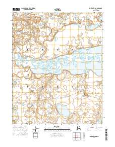
2014 Map of Kotzebue A-5 NE
USGS Topo · Published 2014About this map
Bering Land Bridge National Preserve encompasses the majority of this landscape, protecting a critical section of the Seward Peninsula’s northern reaches. The terrain is defined by a dense network of coastal wetlands and thermokarst lakes, reflecting the delicate permafrost environment of the Nugnugaluktuk River basin. In the southern portion of the quadrangle, the Pish River flows through a similarly intricate wetland system before reaching the coast. This 2014 survey captures a moment in the region's management, documenting the presence of the Me_unassigned_lane River Road, a primitive transport route that cuts across the western and central sections of the preserve. The mapping of township boundaries such as t9n r26w and t10n r25w provides the legal framework for this protected wilderness area.
Find a feature on this map
11 named features on this map. Tap any name to fly to it.
Don’t see what you’re looking for? This feature index may not catch every label — zoom into the map to look around manually.
Map Details
Editions of this 2014 Kotzebue A-5 NE Map
This is the sole edition of this map. No revisions or reprints were ever made.
Other maps of this area

1950 · Kotzebue B-4
USGS Topo · 1:63,360

1950 · Kotzebue B-5
USGS Topo · 1:63,360

1950 · Kotzebue A-4
USGS Topo · 1:63,360

1950 · Kotzebue A-5
USGS Topo · 1:63,360

1951 · Kotzebue
USGS Topo · 1:250,000

1958 · Kotzebue
USGS Topo · 1:250,000

1964 · Kotzebue
USGS Topo · 1:250,000
2014 · Kotzebue A-4 SW
USGS Topo · 1:25,000
2014 · Kotzebue A-5 SE
USGS Topo · 1:25,000
2014 · Kotzebue A-5 SW
USGS Topo · 1:25,000