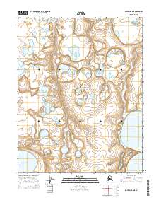
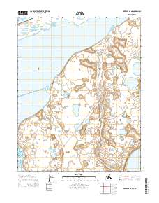
2014 Map of Kotzebue B-6 NE
USGS Topo · Published 2014About this map
Bering Land Bridge National Preserve encompasses most of this coastal Seward Peninsula landscape, where the tundra is defined by a dense network of thaw lakes and winding waterways. The Kalik River meanders southward through the central plains, while the Kitluk River flows along the eastern edge of the survey. The terrain is marked by the unique geology of the Devil Mountain Lakes, part of a volcanic maar system that creates distinct circular depressions in the low-lying permafrost. Towards the southwest corner, White Fish Lake sits amidst a complex of smaller unnamed ponds, illustrating the typical hydrology of this subarctic environment. The lack of roads or permanent structures reflects the protected and wild character of this region of Alaska, preserved as a corridor for understanding the ancient migrations between continents.
Find a feature on this map
11 named features on this map. Tap any name to fly to it.
Don’t see what you’re looking for? This feature index may not catch every label — zoom into the map to look around manually.
Map Details
Editions of this 2014 Kotzebue B-6 NE Map
This is the sole edition of this map. No revisions or reprints were ever made.
Other maps of this area

1950 · Kotzebue C-6
USGS Topo · 1:63,360
1950 · Kotzebue C-5
USGS Topo · 1:63,360

1950 · Kotzebue B-5
USGS Topo · 1:63,360

1950 · Kotzebue B-6
USGS Topo · 1:63,360

1951 · Kotzebue
USGS Topo · 1:250,000

1958 · Kotzebue
USGS Topo · 1:250,000

1964 · Kotzebue
USGS Topo · 1:250,000
2014 · Kotzebue B-5 SW
USGS Topo · 1:25,000
2014 · Kotzebue B-6 SW
USGS Topo · 1:25,000
2014 · Kotzebue B-6 NW
USGS Topo · 1:25,000