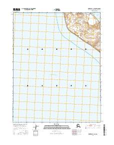
2016 Map of Kotzebue C-1 SE
USGS Topo · Published 2016About this map
Kotzebue Sound dominates this coastal survey, where the open waters of the Chukchi Sea meet the complex shoreline of Northwest Arctic Alaska. In the northeastern corner, the land reveals a dense network of small lakes and marshes characteristic of the tundra landscape, separating the sound from the sheltered waters of Hotham Inlet. This area is part of the traditional lands of the Iñupiat, and the map captures the transition between the vast marine environment and the permafrost-underlain terrestrial terrain. Apart from the maritime features and the delicate hydrology of the coastal fringe, the sheet remains largely devoid of modern development, reflecting the remote and preserved state of the Baldwin Peninsula region during this period.
Find a feature on this map
5 named features on this map. Tap any name to fly to it.
Don’t see what you’re looking for? This feature index may not catch every label — zoom into the map to look around manually.
Map Details
Editions of this 2016 Kotzebue C-1 SE Map
This is the sole edition of this map. No revisions or reprints were ever made.
Other maps of this area

1951 · Selawik
USGS Topo · 1:250,000

1951 · Kotzebue
USGS Topo · 1:250,000

1951 · Selawik C-6
USGS Topo · 1:63,360

1951 · Selawik B-6
USGS Topo · 1:63,360
1951 · Kotzebue C-1
USGS Topo · 1:63,360

1957 · Selawik
USGS Topo · 1:250,000

1958 · Kotzebue
USGS Topo · 1:250,000

1964 · Kotzebue
USGS Topo · 1:250,000
2014 · Kotzebue C-1 NW
USGS Topo · 1:25,000
2016 · Selawik B-6 NW
USGS Topo · 1:25,000