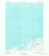
1950 Map of Kotzebue C-6
USGS Topo · Published 1972About this map
Shishmaref Inlet defines the coastal landscape of this Seward Peninsula region, where the tidewaters meet a low-lying expanse of wetlands and small ponds. Mapped from aerial photography taken in 1949 and 1950, the sheet documents the interface of the Chukchi Sea and the Arctic Ocean along a shifting shoreline. The isolation of the northern coast is punctuated only by small coastal settlements like Kividlo and Singoak, which are positioned near the mouth of the inlet. Inland, the Kalik River meanders through a labyrinth of unnamed lakes and marshy tundra, illustrating the drainage patterns of this subarctic environment before any modern infrastructure or trails were established in the area.
Find a feature on this map
6 named features on this map. Tap any name to fly to it.
Don’t see what you’re looking for? This feature index may not catch every label — zoom into the map to look around manually.
Map Details
Editions of this 1950 Kotzebue C-6 Map
3 editions found
Other maps of this area

1950 · Kotzebue C-6
USGS Topo · 1:63,360

1950 · Shishmaref
USGS Topo · 1:250,000
1950 · Kotzebue C-5
USGS Topo · 1:63,360

1950 · Shishmaref B-1
USGS Topo · 1:63,360

1950 · Kotzebue B-5
USGS Topo · 1:63,360

1950 · Kotzebue B-6
USGS Topo · 1:63,360

1951 · Shishmaref
USGS Topo · 1:250,000

1951 · Kotzebue
USGS Topo · 1:250,000

1958 · Kotzebue
USGS Topo · 1:250,000

1964 · Kotzebue
USGS Topo · 1:250,000