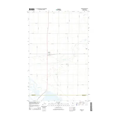
2014 Map of Kramer
USGS Topo · Published 2014About this map
Kramer serves as the central hub of this prairie landscape, situated along the intersection of ND-14 and CR-20. The town's surrounding layout is defined by the rigid grid of section-line roads, such as 92nd St NW and 84th St NE, which reflect the region's enduring agricultural organization. The southern portion of the quadrangle is dominated by the meandering course of the Souris River, which creates a complex pattern of wetlands and oxbows as it crosses the boundary between Bottineau Co and McHenry Co. Further north, Stone Creek winds eastward toward the feature labeled White. Genealogists will find the Kramer Cem located east of the townsite along 87th St NE, providing a specific point of interest for family history research in this rural portion of the Great Plains.
Find a feature on this map
23 named features on this map. Tap any name to fly to it.
Don’t see what you’re looking for? This feature index may not catch every label — zoom into the map to look around manually.
Map Details
Editions of this 2014 Kramer Map
This is the sole edition of this map. No revisions or reprints were ever made.
Other maps of this area

1949 · Kramer
USGS Topo · 1:24,000

1950 · Kramer
USGS Topo · 1:24,000

1950 · Upham SE
USGS Topo · 1:24,000

1950 · Deep
USGS Topo · 1:24,000

1950 · Upham
USGS Topo · 1:24,000

1950 · Newburg SE
USGS Topo · 1:24,000

1954 · Souris SW
USGS Topo · 1:24,000

1954 · Landa SE
USGS Topo · 1:24,000

1954 · Souris SE
USGS Topo · 1:24,000

1954 · Minot
USGS Topo · 1:250,000