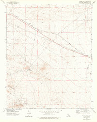
1973 Map of Kramer Hills
USGS Topo · Published 1976About this map
The Kramer Hills dominate the southern portion of this High Desert landscape, where the legacy of early twentieth-century infrastructure remains visible. The rail corridor of the Atchison Topeka and Santa Fe cuts diagonally across the northern plains, paralleled by an Old RR Grade and a major Pipeline. Small desert outposts like Jimgrey and Hawes serve as quiet markers along the transit line, while the Hawes Auxiliary Airport highlights the region's strategic utility.
Find a feature on this map
15 named features on this map. Tap any name to fly to it.
Don’t see what you’re looking for? This feature index may not catch every label — zoom into the map to look around manually.
Map Details
Editions of this 1973 Kramer Hills Map
This is the sole edition of this map. No revisions or reprints were ever made.
Other maps of this area

1915 · Searles Lake
USGS Topo · 1:250,000

1932 · Barstow
USGS Topo · 1:125,000

1934 · Barstow
USGS Topo · 1:125,000

1937 · Kramer
USGS Topo · 1:48,000

1942 · Kramer
USGS Topo · 1:62,500

1947 · Kramer
USGS Topo · 1:24,000

1947 · Johannesburg SE
USGS Topo · 1:25,000

1947 · Red Buttes
USGS Topo · 1:24,000

1947 · Trona
USGS Topo · 1:250,000

1948 · Trona
USGS Topo · 1:250,000