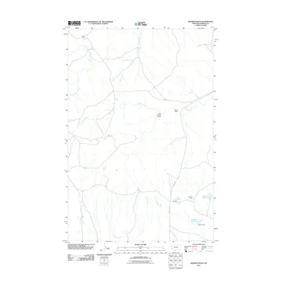
2011 Map of Kramer Ranch
USGS Topo · Published 2011About this map
Kramer Ranch anchors this portion of Garfield County, where the high plains landscape is defined by a network of drainage systems and isolated water sources. The map details a cattle-ranching environment at the start of the 21st century, centered on named landmarks like Blazier Butte and the Tom Birkrem Coulee. Water management is central to the land's utility, evidenced by a series of named catchments including Ten Reservoir, Birkrem Reservoir, and Fourteen Reservoir, along with vital natural outlets like Yoakum Spring and Acorn Spring. The drainage patterns of Little Dry Creek and Little Porcupine Creek reveal the subtle topography of the Big Dry country, while roads such as Ingo Map Rd provide the primary transit through this sparsely populated ranchland.
Find a feature on this map
19 named features on this map. Tap any name to fly to it.
Don’t see what you’re looking for? This feature index may not catch every label — zoom into the map to look around manually.
Map Details
Editions of this 2011 Kramer Ranch Map
This is the sole edition of this map. No revisions or reprints were ever made.
Other maps of this area

1954 · Jordan
USGS Topo · 1:250,000

1954 · Forsyth
USGS Topo · 1:250,000

1956 · Jordan
USGS Topo · 1:250,000

1957 · Forsyth
USGS Topo · 1:250,000

1958 · Jordan
USGS Topo · 1:250,000

1958 · Forsyth
USGS Topo · 1:250,000

1964 · Jordan
USGS Topo · 1:250,000

1965 · Acorn Flats
USGS Topo · 1:24,000

1965 · Kramer Ranch
USGS Topo · 1:24,000

1965 · Hole-In-The-Rock
USGS Topo · 1:24,000