
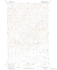
1965 Map of Kramer Ranch
USGS Topo · Published 1968About this map
Kramer Ranch anchors the northern reaches of this Garfield County landscape, a region defined by its reliance on isolated water sources and ranching infrastructure during the mid-1960s. The map reveals a complex network of springs and man-made impoundments essential for livestock and settlement in this semi-arid terrain. Named features such as Birkrem Tom Spring, Lemon Spring, and Yoakum Spring punctuate the draws, while Birkrem Reservoir, Ten Reservoir, and Fourteen Reservoir indicate the managed water system of the era.
Find a feature on this map
17 named features on this map. Tap any name to fly to it.
Don’t see what you’re looking for? This feature index may not catch every label — zoom into the map to look around manually.
Map Details
Editions of this 1965 Kramer Ranch Map
2 editions found
Other maps of this area

1954 · Jordan
USGS Topo · 1:250,000

1954 · Forsyth
USGS Topo · 1:250,000

1956 · Jordan
USGS Topo · 1:250,000

1957 · Forsyth
USGS Topo · 1:250,000

1958 · Jordan
USGS Topo · 1:250,000

1958 · Forsyth
USGS Topo · 1:250,000

1964 · Jordan
USGS Topo · 1:250,000

1965 · Acorn Flats
USGS Topo · 1:24,000

1965 · Hole-In-The-Rock
USGS Topo · 1:24,000
1965 · Darby Buttes SW
USGS Topo · 1:24,000