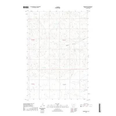
2020 Map of Kramer Ranch
USGS Topo · Published 2020About this map
Kramer Ranch anchors this high-plains landscape in Garfield County, where the topography is defined by the drainage systems of Little Dry Cr and Little Porcupine Cr. The map reveals a land managed for water and livestock, evidenced by family-named landmarks like Tom Birkrem Coulee and several catchment sites including Ten Reservoir, Birkrem Reservoir, and Fourteen Reservoir. Reliable water sources remain vital to the local geography, with Lemon Spring, Yoakum Spring, and Acorn Spring scattered across the township lines. Transportation through this remote section of Montana relies on unpaved routes such as Ingomar Rd and W Little Dry Rd, which traverse the coulees and navigate around prominent elevations like Blazier Butte. The intricate network of seasonal waterways like Heist Cr and Acorn Cr illustrates the erosive character of the terrain.
Find a feature on this map
22 named features on this map. Tap any name to fly to it.
Don’t see what you’re looking for? This feature index may not catch every label — zoom into the map to look around manually.
Map Details
Editions of this 2020 Kramer Ranch Map
This is the sole edition of this map. No revisions or reprints were ever made.
Other maps of this area

1954 · Jordan
USGS Topo · 1:250,000

1954 · Forsyth
USGS Topo · 1:250,000

1956 · Jordan
USGS Topo · 1:250,000

1957 · Forsyth
USGS Topo · 1:250,000

1958 · Jordan
USGS Topo · 1:250,000

1958 · Forsyth
USGS Topo · 1:250,000

1964 · Jordan
USGS Topo · 1:250,000

1965 · Acorn Flats
USGS Topo · 1:24,000

1965 · Kramer Ranch
USGS Topo · 1:24,000

1965 · Hole-In-The-Rock
USGS Topo · 1:24,000