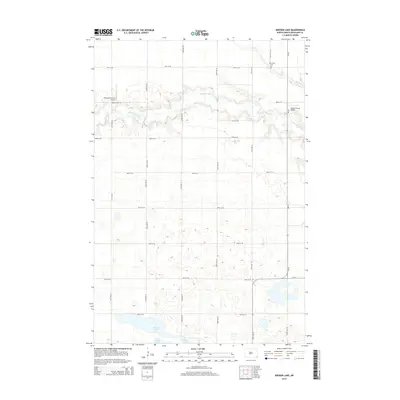
2014 Map of Kreiser Lake
USGS Topo · Published 2014About this map
Wild Rice River meanders across the northern portion of this Richland County landscape, carving a distinct valley through the otherwise level agricultural terrain. The map captures a quintessential section of the Red River Valley region, where the section-line road grid, including CO Road 17 and ND-18, dictates the layout of modern farmsteads. To the south, the namesake Kreiser Lake and nearby Silver Lake provide a hydrological focal point, while the smaller drainage of Elk Creek flows through the northeast corner. This 2014 survey document highlights the persistent rural character of the area, punctuated only by essential community markers like the Elk Creek Cem and private aviation strips such as Thompson Private Airport and Krause Private Airport. The topography reveals the subtle shifts in elevation that define drainage patterns in this heavily glaciated prairie environment.
Find a feature on this map
27 named features on this map. Tap any name to fly to it.
Don’t see what you’re looking for? This feature index may not catch every label — zoom into the map to look around manually.
Map Details
Editions of this 2014 Kreiser Lake Map
This is the sole edition of this map. No revisions or reprints were ever made.
Other maps of this area

1907 · Wyndmere
USGS Topo · 1:125,000

1953 · Fargo
USGS Topo · 1:250,000

1956 · Fargo
USGS Topo · 1:250,000

1958 · Hamlin
USGS Topo · 1:24,000

1958 · Geneseo
USGS Topo · 1:24,000

1960 · Wyndmere
USGS Topo · 1:24,000

1960 · Wyndmere SE
USGS Topo · 1:24,000

1960 · De Lamere
USGS Topo · 1:24,000

1964 · Kreiser Lake
USGS Topo · 1:24,000

1964 · Moselle
USGS Topo · 1:24,000
Featured Places
- Dexter Township, ND
- Wyndmere Township, ND
- Liberty Grove Township, ND
- Danton Township, ND
- Richland County, ND