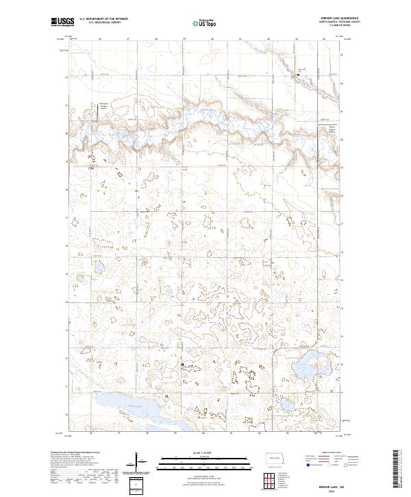
2024 Map of Kreiser Lake
USGS Topo · Published 2024About this map
Wild Rice River meanders across this corner of Richland County, defining a prairie landscape of potholes and wetlands typical of the Red River Valley region. This contemporary survey details a rural area primarily organized by the Public Land Survey System, with a network of gravel roads such as Co Rd 16 and 87th St SE carving through the agricultural sections. Historically significant landmarks are anchored by quiet resting places, including Otterburn Cem in the south and Elk Creek Cem near the northern boundary. Small-scale aviation is represented by Thompson Private Airport and Krause Private Airport, reflecting the modern necessity for aerial oversight in large-scale farming. To the southwest, the eponymous Kreiser Lake sits amidst a cluster of smaller unnamed ponds, illustrating the glacial hydrography of the North Dakota plains.
Find a feature on this map
21 named features on this map. Tap any name to fly to it.
Don’t see what you’re looking for? This feature index may not catch every label — zoom into the map to look around manually.
Map Details
Editions of this 2024 Kreiser Lake Map
This is the sole edition of this map. No revisions or reprints were ever made.
Other maps of this area

1907 · Wyndmere
USGS Topo · 1:125,000

1953 · Fargo
USGS Topo · 1:250,000

1956 · Fargo
USGS Topo · 1:250,000

1958 · Hamlin
USGS Topo · 1:24,000

1958 · Geneseo
USGS Topo · 1:24,000

1960 · Wyndmere
USGS Topo · 1:24,000

1960 · Wyndmere SE
USGS Topo · 1:24,000

1960 · De Lamere
USGS Topo · 1:24,000

1964 · Kreiser Lake
USGS Topo · 1:24,000

1964 · Moselle
USGS Topo · 1:24,000
Featured Places
- Liberty Grove Township, ND
- Danton Township, ND
- Dexter Township, ND
- Wyndmere Township, ND
- Richland County, ND