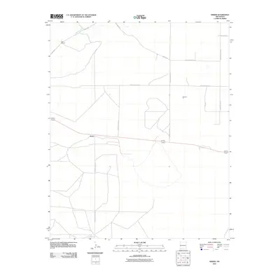
2010 Map of Krider
USGS Topo · Published 2010About this map
Krider sits at the center of this 2010 survey of the High Plains in Roosevelt County, where the landscape is defined by a rigid grid of rural transport routes. The settlement serves as a focal point along a primary east-west corridor, surrounded by an expansive network of local roads including N Roosevelt Road 14 and N Roosevelt Road AS. To the north, the terrain is briefly interrupted by the winding path of Alamosa Creek and the landmark Dobie Windmill, markers of the region's ranching and water management history.
Find a feature on this map
15 named features on this map. Tap any name to fly to it.
Don’t see what you’re looking for? This feature index may not catch every label — zoom into the map to look around manually.
Map Details
Editions of this 2010 Krider Map
This is the sole edition of this map. No revisions or reprints were ever made.
Other maps of this area

1954 · Clovis
USGS Topo · 1:250,000

1957 · Melrose
USGS Topo · 1:62,500

1958 · Clovis
USGS Topo · 1:250,000

1973 · Tolar
USGS Topo · 1:24,000

1973 · Krider
USGS Topo · 1:24,000

1973 · Melrose West
USGS Topo · 1:24,000

1973 · Tule Lake
USGS Topo · 1:24,000
1973 · Peach Canyon
USGS Topo · 1:24,000

1973 · Field SW
USGS Topo · 1:24,000
1973 · House SE
USGS Topo · 1:24,000