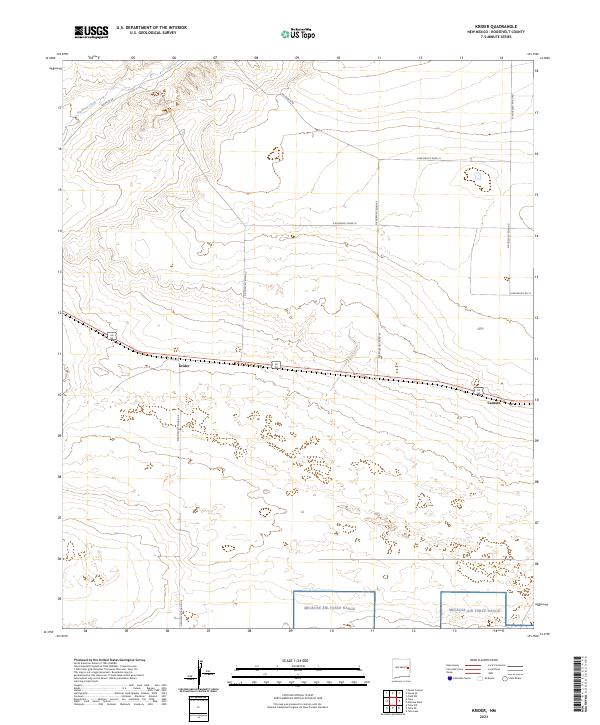
2023 Map of Krider
USGS Topo · Published 2023About this map
The railroad settlements of Krider and Cantara anchor this high plains landscape in Roosevelt County. Located in the Llano Estacado region, the area is defined by a sparse network of section-line roads, including Franklin Rd and Hill-Ranch Rd, which navigate the subtle topography of the northeastern corner. In the northwest, the ephemeral channel of Alamosa Creek provides the primary natural drainage, while the southern portion of the quadrangle is occupied by the restricted territory of the Melrose Air Force Range. This 2023 survey illustrates the continued spatial dominance of military land use and large-scale ranching operations, where the infrastructure of the historic rail corridor remains central to the region's geography.
Find a feature on this map
18 named features on this map. Tap any name to fly to it.
Don’t see what you’re looking for? This feature index may not catch every label — zoom into the map to look around manually.
Map Details
Editions of this 2023 Krider Map
This is the sole edition of this map. No revisions or reprints were ever made.
Other maps of this area

1954 · Clovis
USGS Topo · 1:250,000

1957 · Melrose
USGS Topo · 1:62,500

1958 · Clovis
USGS Topo · 1:250,000

1973 · Tolar
USGS Topo · 1:24,000

1973 · Krider
USGS Topo · 1:24,000

1973 · Melrose West
USGS Topo · 1:24,000

1973 · Tule Lake
USGS Topo · 1:24,000
1973 · Peach Canyon
USGS Topo · 1:24,000

1973 · Field SW
USGS Topo · 1:24,000
1973 · House SE
USGS Topo · 1:24,000