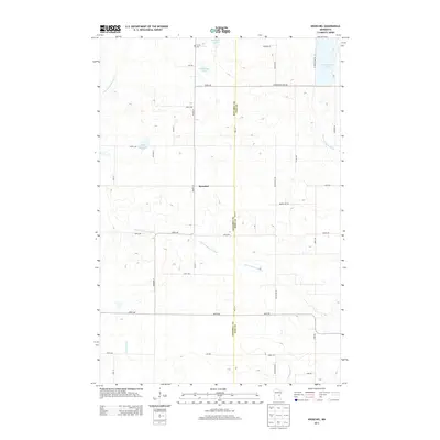
2013 Map of Kroschel
USGS Topo · Published 2013About this map
Kroschel lies at the heart of this landscape where the S Br Grindstone River and Pokegama Cr wind through the wetlands of Kanabec and Pine counties. The settlement patterns here are defined by a grid of rural roads like Beaver Tail Rd and 320th Ave that connect scattered farmsteads and natural landmarks. The presence of Trinity Cem in the north near the boundary indicates a long-standing local community structure. Numerous small lakes, including Thirteen Lake, Featherbed Lake, and White Lily Lake, are scattered across the terrain, illustrating the glacial character of this part of Minnesota. The map also captures the upper reaches of the N Br Grindstone River as it flows toward Grindstone Lake in the northeast corner, reflecting a region where water and wood have traditionally driven local life.
Find a feature on this map
42 named features on this map. Tap any name to fly to it.
Don’t see what you’re looking for? This feature index may not catch every label — zoom into the map to look around manually.
Map Details
Editions of this 2013 Kroschel Map
This is the sole edition of this map. No revisions or reprints were ever made.
Other maps of this area

1953 · Duluth
USGS Topo · 1:250,000

1953 · Stillwater
USGS Topo · 1:250,000

1955 · Stillwater
USGS Topo · 1:250,000

1958 · Stillwater
USGS Topo · 1:250,000

1958 · Duluth
USGS Topo · 1:250,000

1961 · Sandstone
USGS Topo · 1:62,500

1961 · Brook Park
USGS Topo · 1:62,500

1961 · Pine City
USGS Topo · 1:62,500

1965 · Stillwater
USGS Topo · 1:250,000

1968 · Kroschel NW
USGS Topo · 1:24,000