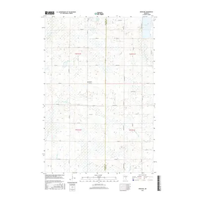
2016 Map of Kroschel
USGS Topo · Published 2016About this map
Kroschel sits at the heart of this East Central Minnesota landscape, where the boundary between Kanabec County and Pine County bisects a terrain defined by glacial lakes and meandering waterways. The township is characterized by a high concentration of wetlands and small water bodies such as Thirteen Lake, Featherbed Lake, and White Lily Lake. Local genealogy is anchored by the Trinity Cemetery in the northern reaches, while the drainage patterns of the South Branch Grindstone River and Pokegama Creek dictate the rural road network. A grid of county and local roads, including Louie Bjerke Road and Peneder Drive, connects the scattered farmsteads and rural residences that comprise this 2016 survey, reflecting a long-standing agricultural and residential pattern established in the early 20th century.
Find a feature on this map
42 named features on this map. Tap any name to fly to it.
Don’t see what you’re looking for? This feature index may not catch every label — zoom into the map to look around manually.
Map Details
Editions of this 2016 Kroschel Map
This is the sole edition of this map. No revisions or reprints were ever made.
Other maps of this area

1953 · Duluth
USGS Topo · 1:250,000

1953 · Stillwater
USGS Topo · 1:250,000

1955 · Stillwater
USGS Topo · 1:250,000

1958 · Stillwater
USGS Topo · 1:250,000

1958 · Duluth
USGS Topo · 1:250,000

1961 · Sandstone
USGS Topo · 1:62,500

1961 · Brook Park
USGS Topo · 1:62,500

1961 · Pine City
USGS Topo · 1:62,500

1965 · Stillwater
USGS Topo · 1:250,000

1968 · Kroschel NW
USGS Topo · 1:24,000