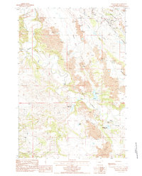
1984 Map of Kruger Lake
USGS Topo · Published 1984About this map
Industrial resource extraction and cattle ranching define this portion of the Belle Fourche River valley. The map reveals an intensive network of Claypits scattered across the landscape, particularly north of the river, suggesting a localized mining economy. Transportation infrastructure is anchored by the Chicago and North Western railroad line passing through the settlement of Colony, which is further serviced by a Wooden Pole Trans Line and a prominent Pipeline.
Find a feature on this map
28 named features on this map. Tap any name to fly to it.
Don’t see what you’re looking for? This feature index may not catch every label — zoom into the map to look around manually.
Map Details
Editions of this 1984 Kruger Lake Map
This is the sole edition of this map. No revisions or reprints were ever made.
Other maps of this area

1901 · Aladdin
USGS Topo · 1:125,000

1903 · Aladdin
USGS Topo · 1:125,000

1954 · The Forks
USGS Topo · 1:24,000

1954 · Gillette
USGS Topo · 1:250,000

1955 · Gillette
USGS Topo · 1:250,000

1957 · Mona
USGS Topo · 1:62,500

1957 · Colony
USGS Topo · 1:62,500

1958 · Gillette
USGS Topo · 1:250,000

1958 · Beulah
USGS Topo · 1:62,500

1962 · Gillette
USGS Topo · 1:250,000