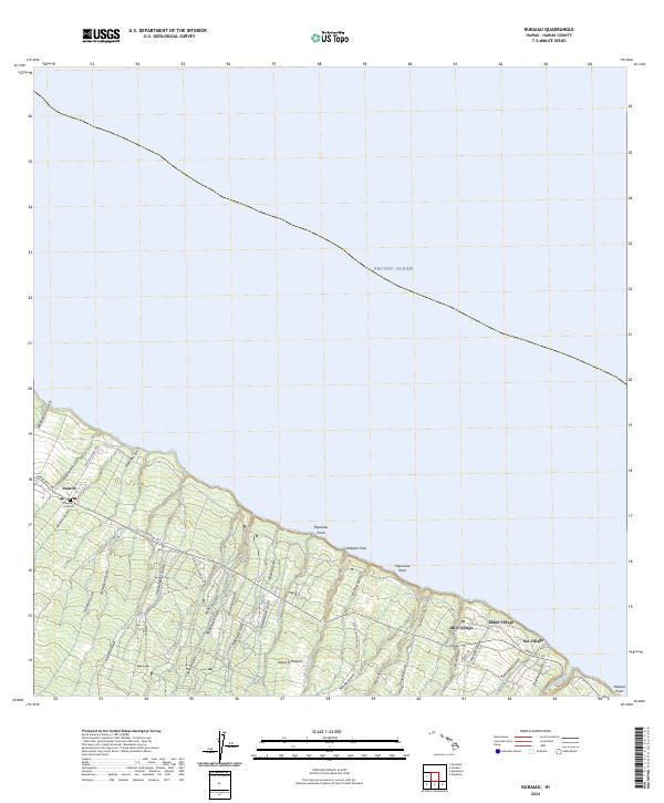
2024 Map of Kukaiau
USGS Topo · Published 2024About this map
Paauilo and several smaller agricultural clusters define this coastal stretch of the Hamakua District on the Island of Hawai'i. The landscape is characterized by a series of deep, parallel ravines and streams, such as Ka'ala Stream and Kealakaha Stream, that carry water from the higher slopes of Mauna Kea toward the Pacific Ocean. Transportation history is visible in the alignment of the Old Mamalahoa Hwy as it winds alongside the modern Hawaii Belt Rd. Small residential groupings like Milo Village, Kukui Village, and Niu Village are situated near the cliffs, reflecting the region's plantation-era layout and rural settlement patterns. Genealogy researchers can locate the Paauilo Hui Cem near the town center. The coastal edge is marked by several prominent geographic features, including Popoloau Point and Nahiwa Point, where the gulches meet the sea.
Find a feature on this map
44 named features on this map. Tap any name to fly to it.
Don’t see what you’re looking for? This feature index may not catch every label — zoom into the map to look around manually.
Map Details
Editions of this 2024 Kukaiau Map
This is the sole edition of this map. No revisions or reprints were ever made.
Other maps of this area

1915 · Hamakua
USGS Topo · 1:62,500

1915 · Honomu
USGS Topo · 1:62,500

1954 · Hawaii North
USGS Topo · 1:250,000

1956 · Keanakolu
USGS Topo · 1:24,000

1956 · Umikoa
USGS Topo · 1:24,000

1957 · Kukaiau
USGS Topo · 1:24,000

1957 · Honokaa
USGS Topo · 1:24,000

1959 · Hawaii North
USGS Topo · 1:250,000

1961 · Hawaii North
USGS Topo · 1:250,000
1966 · Papaaloa
USGS Topo · 1:24,000