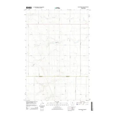
2014 Map of Kulm-Edgeley Dam
USGS Topo · Published 2014About this map
Maple River winds through the northern portion of this agricultural landscape on the border of LaMoure and Dickey counties. The terrain is defined by the drainage patterns surrounding the Kulm-Edgeley Dam, a central hydraulic feature that anchors the local topography. This 2014 survey reveals the enduring rural structure of the region, where a precise grid of township roads like 72nd St SE and 74th Ave SE facilitates movement between expansive fields. For genealogists and local historians, the presence of the Beresena Cem near the intersection of 77th St S and 74th Ave SE provides a critical point of interest, marking a historical site of remembrance within this sparsely populated prairie setting.
Find a feature on this map
19 named features on this map. Tap any name to fly to it.
Don’t see what you’re looking for? This feature index may not catch every label — zoom into the map to look around manually.
Map Details
Editions of this 2014 Kulm-Edgeley Dam Map
This is the sole edition of this map. No revisions or reprints were ever made.
Other maps of this area

1894 · Monango
USGS Topo · 1:62,500

1896 · Edgeley
USGS Topo · 1:125,000

1925 · Edgeley
USGS Topo · 1:125,000

1953 · Jamestown
USGS Topo · 1:250,000

1956 · Jamestown
USGS Topo · 1:250,000

1971 · Merricourt
USGS Topo · 1:24,000

1971 · Merricourt NW
USGS Topo · 1:24,000
1982 · Monango NW
USGS Topo · 1:24,000

1982 · Schlecht-Weixel Dam
USGS Topo · 1:24,000

1982 · Deisem
USGS Topo · 1:24,000