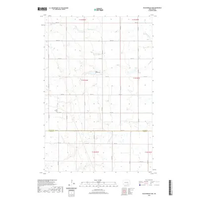
2020 Map of Kulm-Edgeley Dam
USGS Topo · Published 2020About this map
Maple River meanders across the northern sections of this prairie landscape, defining the hydrology of the rural border between LaMoure and Dickey Counties. The terrain is characterized by the structured grid of the Public Land Survey System, where section lines are traced by an extensive network of rural roads such as 74th Ave SE and 76th St SE. A significant water management feature, the Kulm-Edgeley Dam, is situated in the central portion of the map, creating a localized reservoir amidst the undulating plains. For those researching the heritage of the local farming community, the New Beresina Cem serves as a vital genealogical landmark. The region reflects a classic North Dakota agricultural pattern, with scattered homestead sites connected by corridors like Co Hwy 2 and Co Rd 64.
Find a feature on this map
28 named features on this map. Tap any name to fly to it.
Don’t see what you’re looking for? This feature index may not catch every label — zoom into the map to look around manually.
Map Details
Editions of this 2020 Kulm-Edgeley Dam Map
This is the sole edition of this map. No revisions or reprints were ever made.
Other maps of this area

1894 · Monango
USGS Topo · 1:62,500

1896 · Edgeley
USGS Topo · 1:125,000

1925 · Edgeley
USGS Topo · 1:125,000

1953 · Jamestown
USGS Topo · 1:250,000

1956 · Jamestown
USGS Topo · 1:250,000

1971 · Merricourt
USGS Topo · 1:24,000

1971 · Merricourt NW
USGS Topo · 1:24,000
1982 · Monango NW
USGS Topo · 1:24,000

1982 · Schlecht-Weixel Dam
USGS Topo · 1:24,000

1982 · Deisem
USGS Topo · 1:24,000