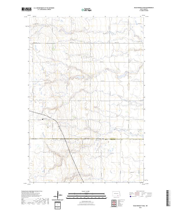
2024 Map of Kulm-Edgeley Dam
USGS Topo · Published 2024About this map
The Maple River meanders across this prairie landscape in southern North Dakota, defining the drainage patterns of the Missouri Coteau region. This 2024 map documents the boundary where LaMoure Co meets Dickey Co, a division reflected in the rigid township and range lines that structure the local agricultural geography. The rural character of the area is highlighted by the Dickey County Waterfowl Production Area, which preserves critical wetland habitat amidst a grid of section roads like Co Hwy 2 and Co Rd 64. For those researching local family history, the New Beresina Cem stands as a significant landmark, marking the heritage of the early German-Russian settlements that once established their homes and community life along these remote sections.
Find a feature on this map
27 named features on this map. Tap any name to fly to it.
Don’t see what you’re looking for? This feature index may not catch every label — zoom into the map to look around manually.
Map Details
Editions of this 2024 Kulm-Edgeley Dam Map
This is the sole edition of this map. No revisions or reprints were ever made.
Other maps of this area

1894 · Monango
USGS Topo · 1:62,500

1896 · Edgeley
USGS Topo · 1:125,000

1925 · Edgeley
USGS Topo · 1:125,000

1953 · Jamestown
USGS Topo · 1:250,000

1956 · Jamestown
USGS Topo · 1:250,000

1971 · Merricourt
USGS Topo · 1:24,000

1971 · Merricourt NW
USGS Topo · 1:24,000
1982 · Monango NW
USGS Topo · 1:24,000

1982 · Schlecht-Weixel Dam
USGS Topo · 1:24,000

1982 · Deisem
USGS Topo · 1:24,000