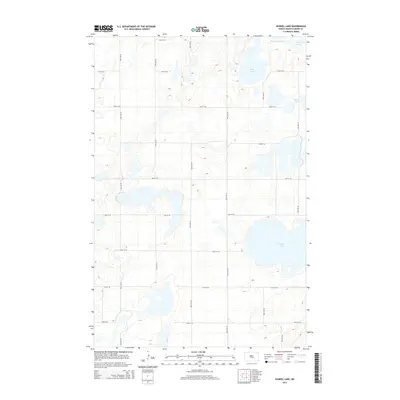
2014 Map of Kunkel Lake
USGS Topo · Published 2014About this map
Kunkel Lake dominates the southeast corner of this central North Dakota landscape, situated within a prairie pothole region defined by its numerous semi-permanent water bodies. The terrain is characterized by a high concentration of depressions and internal drainage points, most notably Sink Lake and Des Moines Lake in the north. A precise grid of township roads, including 25th St SE and 38th Ave SE, sections the land into predictable blocks, reflecting the legacy of the Public Land Survey System across Kidder County. Smaller basins like Iowa Lake and South Lake further illustrate the glaciated nature of the Missouri Coteau, where the lack of an integrated river network makes these isolated lakes vital markers for local land use and hydrology.
Find a feature on this map
20 named features on this map. Tap any name to fly to it.
Don’t see what you’re looking for? This feature index may not catch every label — zoom into the map to look around manually.
Map Details
Editions of this 2014 Kunkel Lake Map
This is the sole edition of this map. No revisions or reprints were ever made.
Other maps of this area

1952 · Tappen NE
USGS Topo · 1:24,000

1952 · Tappen North
USGS Topo · 1:24,000

1952 · Steele NE
USGS Topo · 1:24,000

1952 · New Rockford
USGS Topo · 1:250,000

1953 · Jamestown
USGS Topo · 1:250,000

1956 · New Rockford
USGS Topo · 1:250,000

1956 · Jamestown
USGS Topo · 1:250,000

1971 · New Rockford
USGS Topo · 1:250,000

1972 · Kunkel Lake
USGS Topo · 1:24,000
1972 · Horsehead Lake
USGS Topo · 1:24,000